Water Quality Data
Interested in viewing data around the Long Island Sound?
Friends of the Bay was proud to be one of the first groups to contribute data to a new data sharing platform developed by Save the Sound called QuickDrops. QuickDrops is the first database of its kind designed to collect, manage, and broadly share water quality data specific to the Long Island Sound watershed. Check out data from all around the sound by creating a free account at quickdrops.org
Pathogen Monitoring
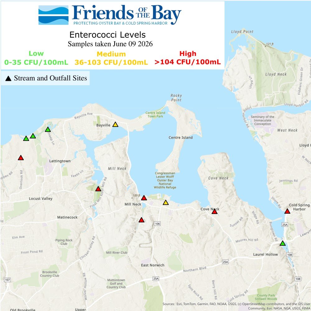
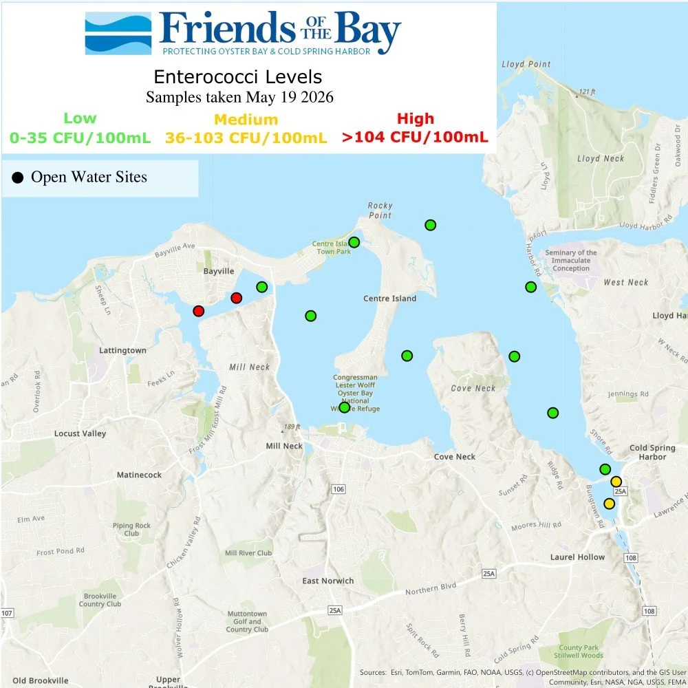
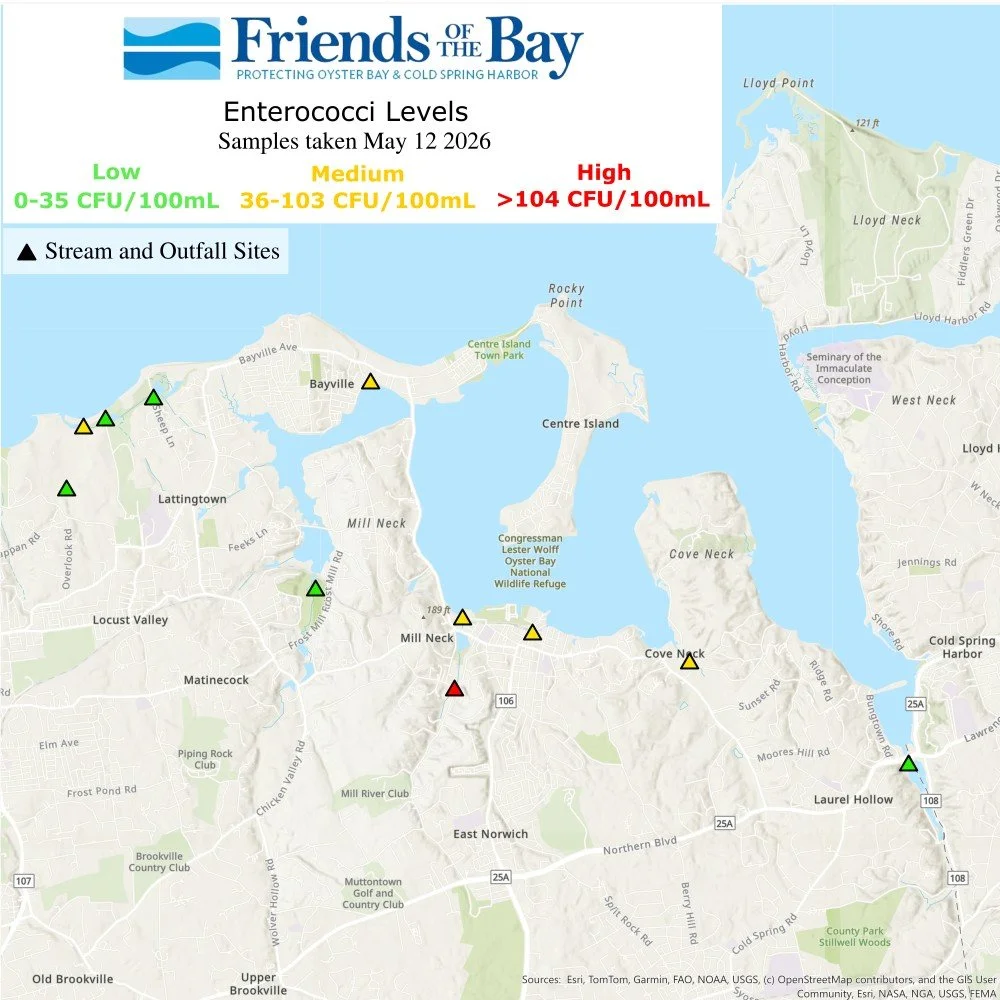
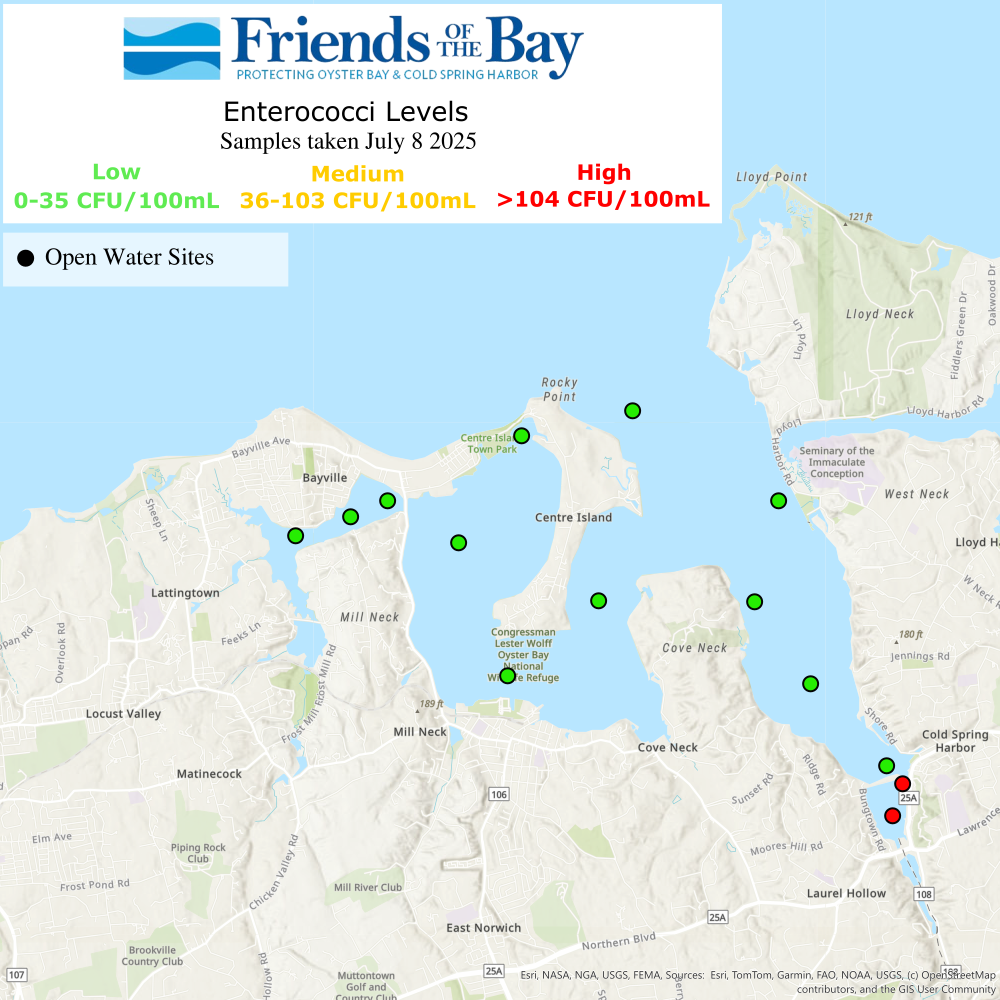
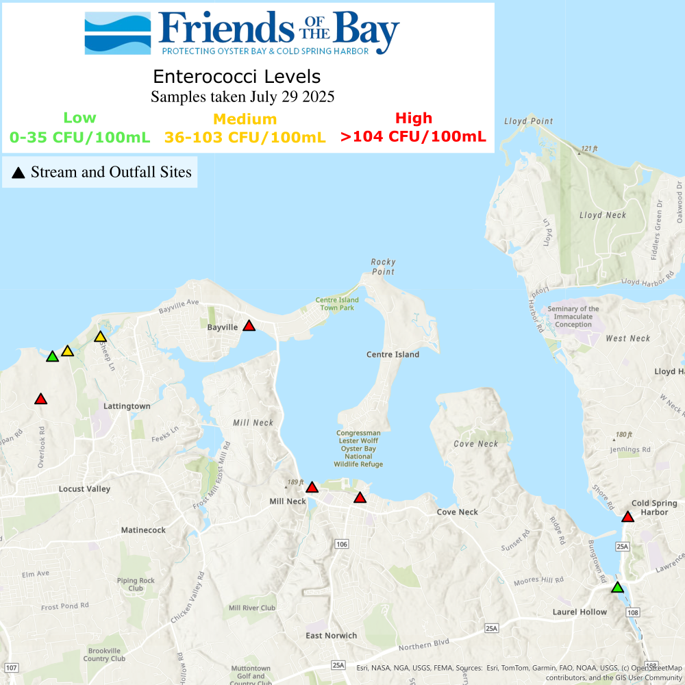
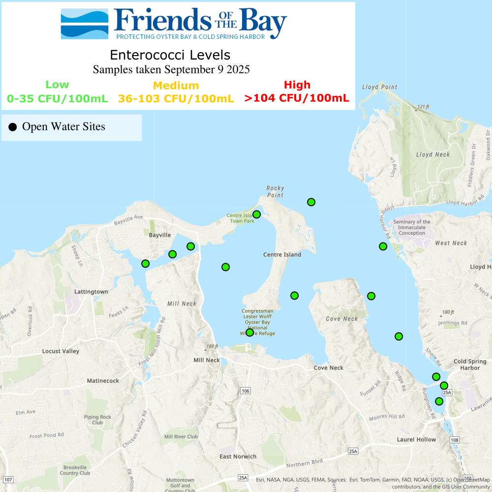
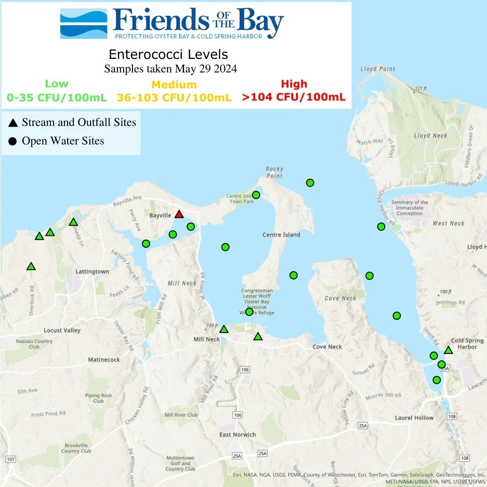
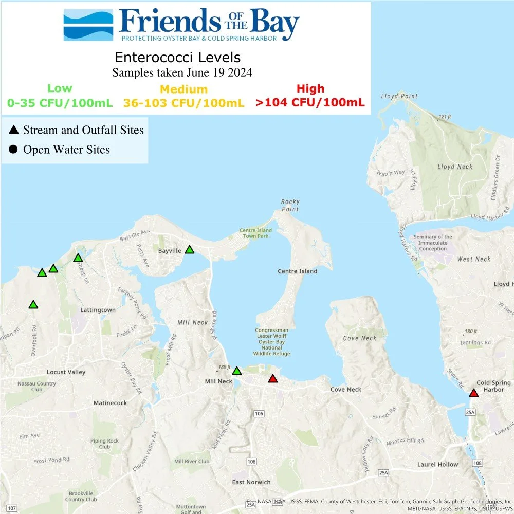
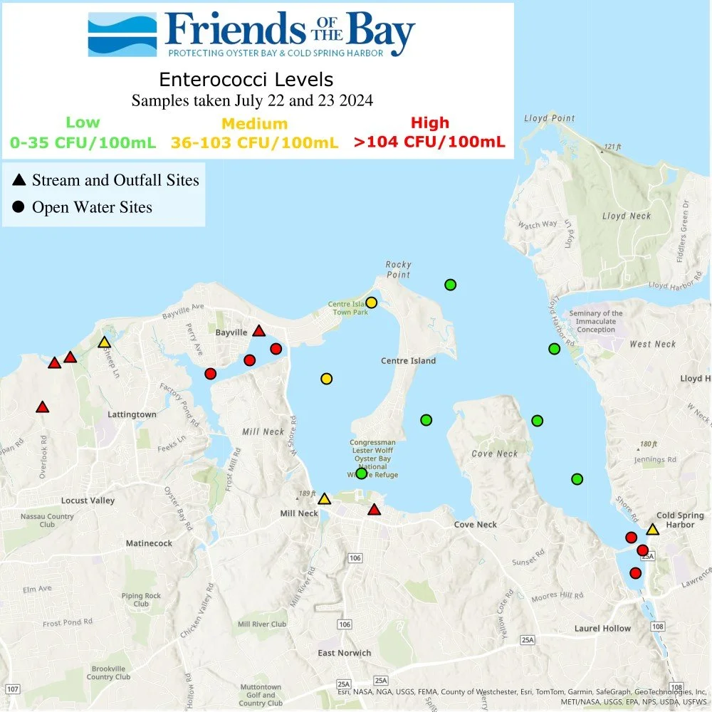
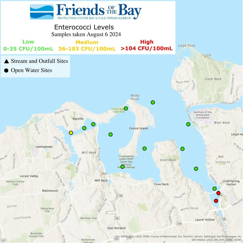
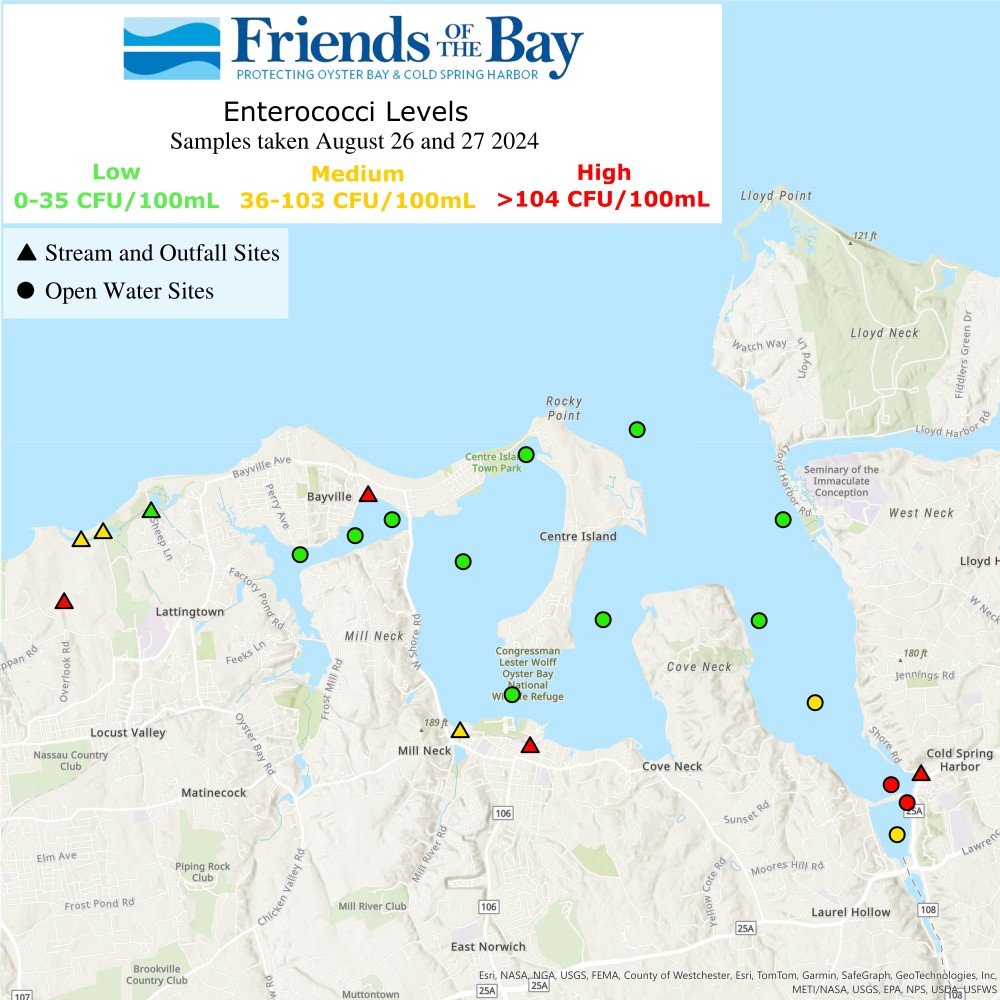
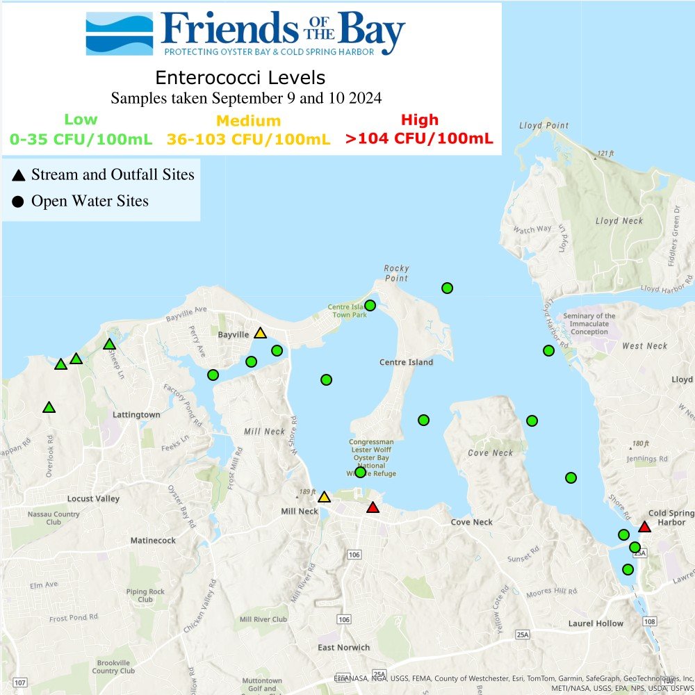
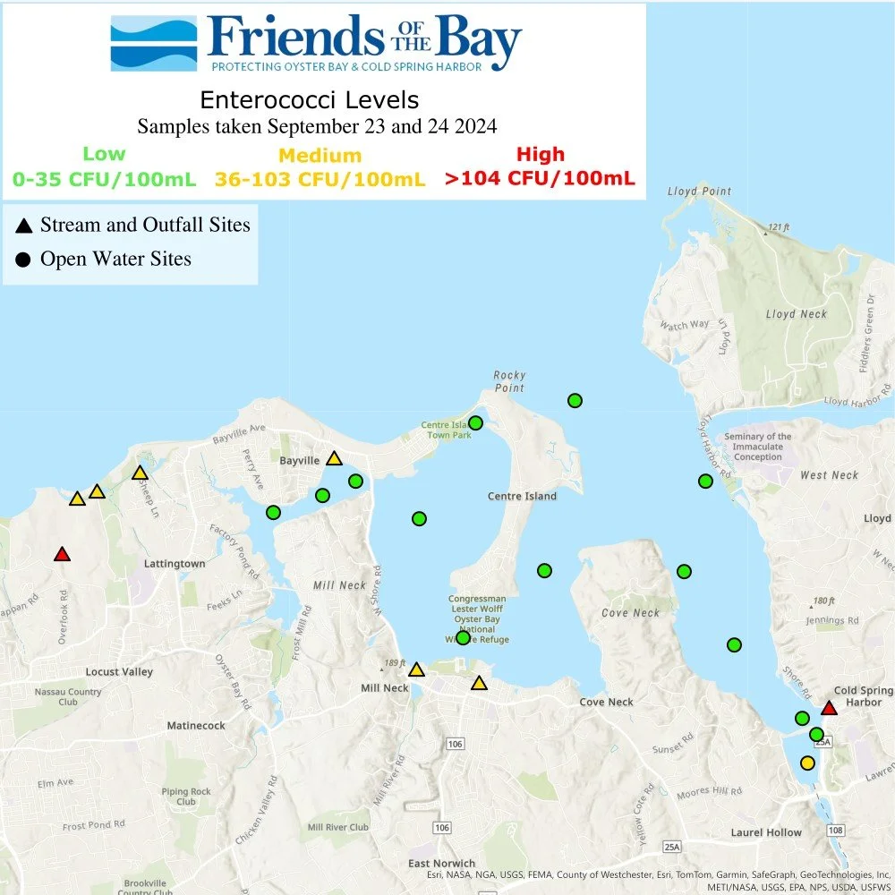
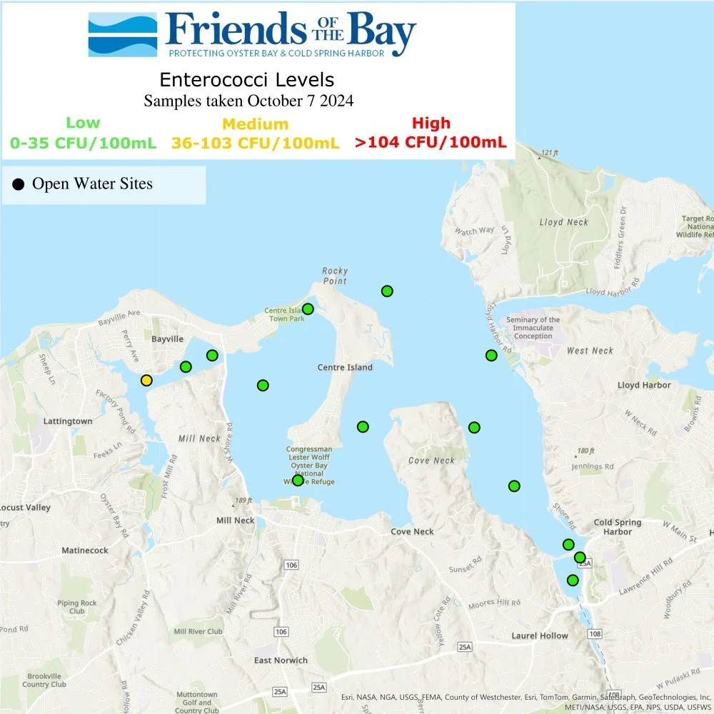
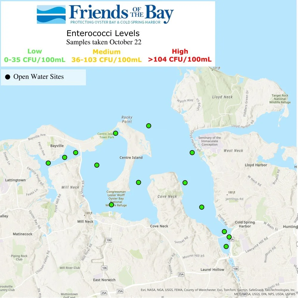
One of the questions we get asked most often is, "How clean is the water in Oyster Bay?" Bacteria levels play a major role in providing an answer to that question. At Friends of the Bay we measure the number of coliform bacteria and enterococci around Oyster Bay's waters.
We currently take water samples every other week from May through October at 14 open-water sites and ten tributary/outfall sites from Lattingtown to Cold Spring Harbor. We bring those samples to the Nassau County Deprtment of Health where they are tested for enterococci and fecal coliform bacteria.
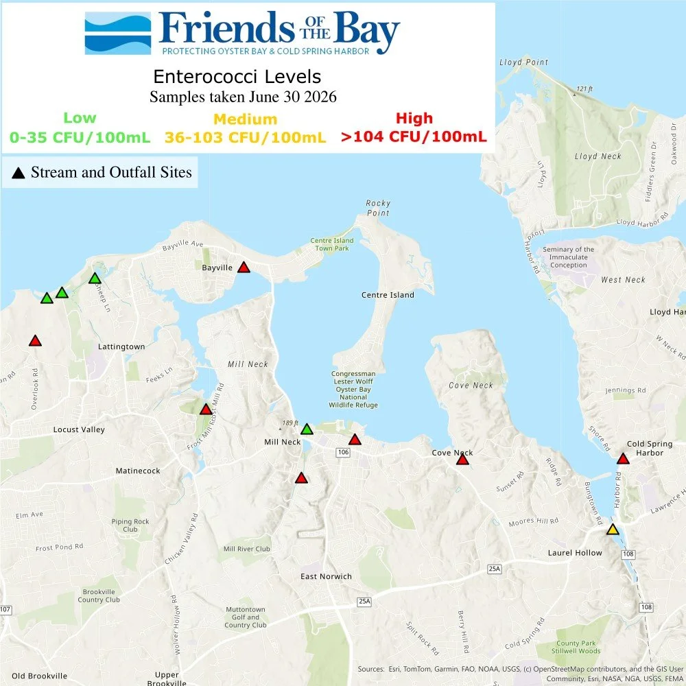
Below is a map of enterococci bacteria data with low, medium and high bacteria color coding so it is easy to see how bacteria levels vary within our bay and watershed. This map will be updated approximately every two weeks when we take new samples.
See the current and previous maps by clicking on the arrows or icons below


Site Locations
Stream and Outfall sites ▲
▲ Spring Street Outfall, Cold Spring Harbor
▲ Cold Spring Harbor Hatchery, Cold Spring Harbor
▲ Tiffany Creek, Oyster Bay
▲ Mill Pond Headwaters, Oyster Bay
▲ White’s Creek Outfall, Oyster Bay
▲ Beekman Beach Outfall, Oyster Bay
▲ Beaver Brook, Mill Neck
▲ Adams Avenue Outfall, Bayville
▲ Tributary at Meudon Drive and Parish Drive, Lattingtown
▲ Frost Creek Drive Bridge, Lattingtown
▲ Creek Club, Lattingtown
▲ Sheep Lane Bridge at Frost Creek, Lattingtown
Open Water Sites ●
● Cold Spring Cove South, Cold Spring Harbor
● Cold Spring Cove North, Cold Spring Harbor
● Cold Spring Beach North, Cold Spring Harbor
● Cold Spring Harbor South, Cold Spring Harbor
● Laurel Hollow, Cold Spring Harbor
● Lloyd Beach, Cold Spring Harbor
● Centre Island North, Cold Spring Harbor
● Moses Point, Oyster Bay
● Roosevelt Beach, Oyster Bay
● West Harbor, Oyster Bay
● Turtle Cove, Oyster Bay
● Creekview, Mill Neck Creek
● Mill Neck Creek East, Mill Neck Creek
● Mill Neck Creek West, Mill Neck Creek
Fecal Coliform & Enterecocci Bacteria
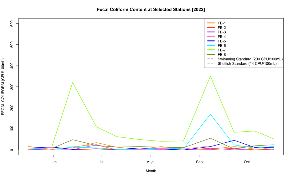
Coliform bacteria are an accumulation of different bacteria species, including both fecal and non-fecal bacteria. The fecal coliform bacteria are found in the intestines of warm-blooded animals, some fecal coliform species are disease-causing. When fecal coliform is present in water bodies it indicates possible contamination from human or animal fecal matter.
Enterococci are a different type of fecal bacteria found in warm-blooded animal intestines. They are a subgroup of fecal streptococcus that can live in salt water. Enterococci is an indicator organism at shellfish harvesting areas and coastal beaches. We use both types of bacteria as water quality indicators.
Bacteria levels can fluctuate throughout different areas of Oyster Bay, Mill Neck Creek and Cold Spring Harbor depending on rainfall, the amount of runoff entering the water and the amount of tidal flushing. Bacteria levels can vary geographically, especially in areas of the bay bordered by streams or outfall pipes.
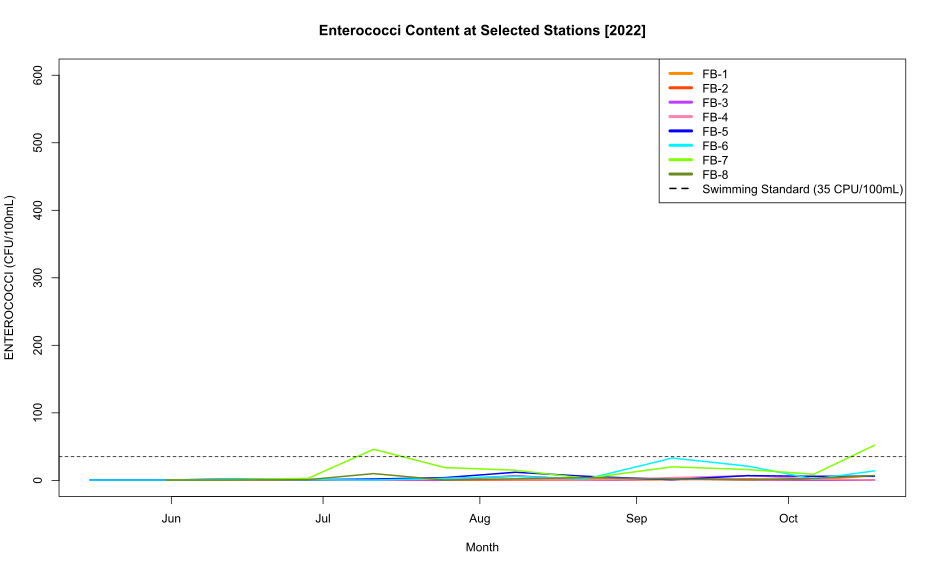
When a beach is closed for swimming after a heavy rainfall, it is because bacteria levels are too high, and it is a good idea to wait 48 hours before going swimming. Swimming standards are set by New York State and if enterococci levels are above 104 cfu (colony forming units) per 100 millileters it is unsafe to swim.
Friends of the Bay received a Quality Assurance Project Plan from the Environmental Protection Agency in April of 2006 and was later updated in June 2020. Friends of the Bay has a long-standing water quality monitoring program which began in the late 1990s. Data from 2005 and earlier is available upon request.
Since the late 1990s. Friends of the Bay ran its own core water quality monitoring program which included sampling for pathogens. Since 2017 we have been participating in the Unified Water Study. To avoid redundancy we concluded our core monitoring program in 2024 and became fully invested in the Unified Water Study while still maintaining the pathogen monitoring part of our core program.
Data From Previous Years
- 2025 Data -


- 2024 Data -


Site Locations
Stream and Outfall sites ▲
▲ Spring Street Outfall, Cold Spring Harbor
▲ White’s Creek Outfall, Oyster Bay
▲ Beekman Beach Outfall, Oyster Bay
▲ Adams Avenue Outfall, Bayville
▲ Tributary at Meudon Drive and Parish Drive, Lattingtown
▲ Frost Creek Drive Bridge, Lattingtown
▲ Creek Club, Lattingtown
▲ Sheep Lane Bridge at Frost Creek, Lattingtown
Open Water Sites ●
● Cold Spring Cove South, Cold Spring Harbor
● Cold Spring Cove North, Cold Spring Harbor
● Cold Spring Beach North, Cold Spring Harbor
● Cold Spring Harbor South, Cold Spring Harbor
● Laurel Hollow, Cold Spring Harbor
● Lloyd Beach, Cold Spring Harbor
● Centre Island North, Cold Spring Harbor
● Moses Point, Oyster Bay
● Roosevelt Beach, Oyster Bay
● West Harbor, Oyster Bay
● Turtle Cove, Oyster Bay
● Creekview, Mill Neck Creek
● Mill Neck Creek East, Mill Neck Creek
● Mill Neck Creek West, Mill Neck Creek
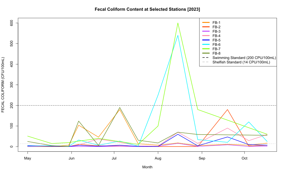
- 2023 Data -
Click here to view the 2023 water quality monitoring raw data
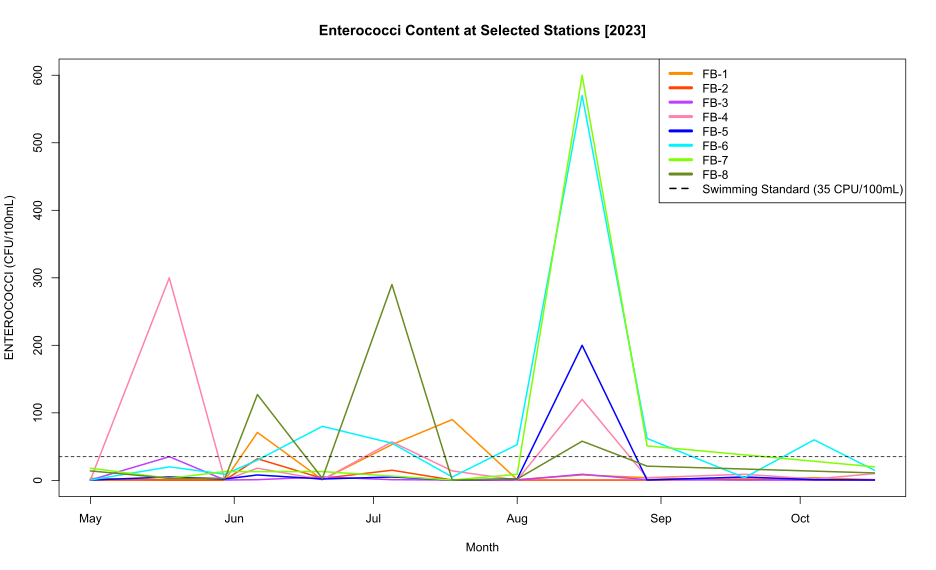
Bacteria Monitoring Levels in 2023 at Friends of the Bay's 8 Sampling Stations
- 2022 Data -
Click here to view the 2022 water quality monitoring raw data
Bacteria Monitoring Levels in 2022 at Friends of the Bay's 8 Sampling Stations